“I’m very concerned about Auroville’s planning future”
An interview with Prashant HedaoBy Carel
Keywords: Town planning, Auroville Town Development Council (ATDC) / L’Avenir d’Auroville, Aurofuture, Landscape architects, GIS (Geographic Information System), Sustainable design, Land-use planning, Environmental Impact Assessment (EIA), Regional planning / bioregional planning, Master Plan (Perspective 2025), Governing Board, Auroville Foundation, Auroville Foundation Act, 1988, Crown Road, Outer Ring Road, Radial roads, Green Belt, Matrimandir Lake, Lines of Force, Edayanachavadi, Evergreen community, Residents’ Assembly (RA) and Working groups
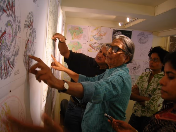
Former Governing Board member Dr B.V. Doshi discusses the Auroville Master Plan with Prashant in 2010, while Tejaswini and Meera look on
Auroville Today: You are trained as a landscape architect. What exactly is landscape architecture and what is its relation to GIS (Geographic Information Systems)?
Prashant: Ideally, before the planning of any project takes off, landscape architects should be hired to do a site analysis, which includes site topography, hydrology, biodiversity, site ecology, human geography and so on. On the basis of the data provided, they make composite maps, also called ‘map overlays’ combining multiple layers that show the relationships between features in a geographic space. Such mapping exercises, also known as suitability analysis, are then used in the planning process, to see where roads and buildings can best be located, where industry could be located and where parks or forested areas should be. Such maps usually include a site inventory, basic land and site planning, water management proposals, location of waste water systems, storm water management and in some cases specifications on sustainable design and construction.
My wife Lata and I studied at the University of Pennsylvania under the late Ian L. McHarg, a Scottish landscape architect known as the father of ecological planning using map overlays. His work had a major impact on the development of GIS. Under McHarg’s guidance, Lata and I also became GIS specialists. We specialised in using GIS to create digital overlay maps and analysing spatial data, and so we can help local area and city planning authorities in developing suitable detailed development plans and maps.
McHarg also brought environmental concerns into the public awareness and designed ecological planning methods as a mainstream of landscape architecture, city planning and public policy. His 1969 book Design with Nature pioneered the concept of ecological planning. It is still one of the most celebrated books on landscape architecture and land-use planning. The book has step-by-step instructions on how to break down a region into its appropriate uses. It contributed to the development of the concepts of environmental impact assessment, new community development, coastal zone management, river corridor planning, and sustainability.
Has landscape architecture using GIS been embraced in India?
No, it hasn’t. Unlike the USA, where GIS analysis is now mandatory for any area development, the Indian government has yet to adopt GIS fully. There is a lack of geographic data and of proper GIS analysing tools. Post the 2004 tsunami, Lata and I worked closely with district and state officials to make them aware of GIS and the value of shared information systems. That was a big national disaster and so we did manage to include GIS in the long term rehabilitation process. But sharing of data is still a problem. The Railways, the Department of Water Resources, the Department of Health, the Department of Environment and Forests, to mention a few, each have their own data sets which they are not always inclined to share. Only a centralised authority could bring them together. Between 2009 and 2014 we tried to convince the Planning Commission of India, the government agency that previously oversaw India’s economic and social development, to become such an authority and so have all data available in one centralised place. We also worked on a draft National GIS bill, to be enacted by the Indian Parliament, which would oblige the different departments of the central and state governments to share their data. But this didn’t happen, and when, in 2014, the Planning Commission of India was dissolved it was abandoned. India still has a long road ahead in this area.
What about Auroville? Does ‘The City The Earth Needs’ set an example to India in this area?
During our time working for L’Avenir d’Auroville (during 2003-04 and again from 2007 to 2011), we put together composite maps of the Auroville area, for use in the planning of the city. The data sets were organised not just for the Master Plan area but also for the extended bioregion, but we never seriously used this data for planning in Auroville. At present, the whole GIS concept has gone out of the window with the planners appointed by the Governing Board only aiming at executing the Auroville Universal Township Master Plan (Perspective 2025) as it was conceived 23 years ago. But since its approval in 2001, neither Five-Year Development Plans nor Annual Plans as prescribed in this Master Plan have been made. Neither was the Master Plan ever adapted to the present and evolving ground realities and our work was ignored. I am very concerned about what this means for Auroville’s planning and how it interfaces with our neighbouring villages, existing road networks, water channels and ponds, human geography, etc.
Can you explain?
The Auroville Foundation Act was passed in 1988 by the Central Government. But India is a union of states, where land and planning are state subjects. Ideally, what should have happened is that after the Auroville Foundation Act was passed, a similar act should have been passed by the Government of Tamil Nadu. That did not happen. At present, Auroville’s Master Plan is not a Master Plan in Tamil Nadu’s planning system. It is a plan of the Auroville Foundation which is an independent juristic entity with large land holdings.
I am bemused that the Tamil Nadu government does not intervene. Any large-scale development even on privately owned land should concern it because such development will have a large impact on the environment, economy, mobility, people’s lives and livelihoods in the surrounding area.
Auroville’s planners, it appears, are at present only concerned about manifesting Auroville’s internal road network consisting of the Crown Road, the Outer Ring Road and the connecting radials. You can now add to that the creation of a 30 metre high hill in the Greenbelt with the earth excavated from the Matrimandir Lake – a project which is not mentioned in the Master Plan – and the plans to build Lines of Force, for which some areas have already been deforested. But there appears to be no consideration about how all this will affect us and the surrounding villages.
For example, one of the largest Lines of Force – 1.2 kilometres long – is planned to be 18 storeys high near the village of Edayanchavadi and tapers down to 2 storeys near the Matrimandir Reception Pavilion on the west shore of the Matrimandir Lake. What impact would such an enormous building have on the village of Edayanchavadi? You will have serious real estate problems. The land prices in that area will steeply increase, and there is a risk of some big developer taking over privately owned land and building another apartment right next to our Line of Force.
The growth of cities and the effect on the surrounding villages that get incorporated in the city is a topic of many films in India. How do these expanding cities merge with the surrounding villages? There is a movie about what happened when the villages around Pune, a city in the state of Maharashtra, got absorbed. The 2018 Marathi film Mulshi Pattern and the 2021 Hindi film Antim: The Final Truth showed the influence of the land mafia, how local youngsters were pulled in and became goons working for them, and how many small landowners were killed because of this. You think I am exaggerating thinking that this might happen here? Look at the recent land controversy near Evergreen community; and remember the killings that happened in our surrounding villages a few years ago. Land is being monetised, in the villages, and, alas, also in Auroville. The land exchanges are nothing but monetisation of the land.
You mentioned the focus on manifesting Auroville’s internal road network as conceived in 2001. How ‘internal’ will this be, taking account of the employees, the visitors and the tourists?
It won’t be internal at all. The Auroville population is only 3,000 residents; but we are catering to at least 25,000 people who come into Auroville each day, counting the interns, volunteers, students, employees, the visitors and the tourists. Is the infrastructure designed for 3,000 or for 25,000 or for 50,000 people?
I’m afraid that the present infrastructure planning – or rather the lack of it – will be leading us into many difficulties. Auroville doesn’t own all the lands required to build the Crown Road or the Outer Ring Road. Currently we have bits and pieces of roads being built that go from nowhere to nowhere or end at a privately owned land. What’s stopping the private landowners from building a resort on their land, to which the Auroville planners have so nicely given access? Or, in case that landowner finally agrees to sell the land to Auroville, what lands does Auroville have to offer in exchange for this land and at what rate of exchange? We all know of the controversies of recent land exchanges and we don’t need to add more.
In a recent email to the town planners and to the Auroville Foundation Office, you summarised your concerns about the general road and pedestrian infrastructure, as it is being developed today. What are your concerns?
This started when, one day without giving any notice to the people who are living in the nearby apartments, a JCB began removing the paver blocks from the Vikas radial. It was a perfectly fine road, wide enough for two JCBs to pass one another. Why did this happen? We don’t know. Then the work suddenly stopped. There was a meeting with the GB appointed TDC personnel and I learned that they wanted to increase the height of the road by 15 cm. Why this was necessary was not explained, nor why the road was being demolished in the middle of the monsoon season, making it treacherous for the traffic.
Also, the consequences of such an elevated road were not mentioned, such as that rainwater might flow from the elevated road into the neighbouring communities which are at a lower level. They promised to provide alternate access for those who reside near this road and that an information board would be erected which would also show the name of the project, start and end date, name of the contractor, total cost and funding sources. So far, these promises have not been kept.
Being a landscape planner I took the opportunity to ask a few more pertinent questions. One was why the Crown Road, which was intended for pedestrians and light traffic, has been built with heavy in-situ concrete, whereas the Outer Ring Road, which would carry heavy traffic, has been built using paver blocks. I did not receive a reply. Neither was there a response to my question about how they plan to make the city pedestrian friendly. In the Perspective Master Plan document, road section drawings show tree-lined sidewalks for pedestrians, but they are not being built. Today, pedestrians have no option but to use the concrete road without shade in the hot summer sun.
Earlier, before the Crown Road was so badly redone, there was shade. The road was flanked on both sides by Service Trees [Peltophorum pterocarpum, eds], children of the Service Tree that shades the Samadhi of Sri Aurobindo and The Mother. With a partial grant-in-aid from the European Commission, which supported the innovative way of planning, these trees had been planted by Aurofuture, Auroville’s then Town Planning Department headed by Chief Architect Roger Anger, with the intention to provide shade for the Crown Road. These trees were brutally cut down. I still question why this was done. But there has been no answer to my questions.
Do you see a way to rectify all this?
Honestly, the only way to bring Auroville’s planning back on track is by reinstating the Residents’ Assembly to manage its day-to-day matters and let it select its working groups, as laid down in the Foundation Act. Until that happens, we residents will be just bystanders to the senseless destruction and construction. The only thing that the Auroville planners could do right now is to use this period to independently work on the next version of our master plan and DDPs, or detail out sections for immediate development. There already exists a body of work and studies that have been done in the past years, bringing them all together and integrating them into planning. One additional thing we will have to work on is what to do with the bits and pieces of road (that go from nowhere to nowhere) constructed in the past two to three years. These pieces are not connected with any mobility plan and are not pedestrian friendly, so maybe they can be converted into plazas or market places with dead ends. We will have to be innovative about it.