Petrichor*
FeatureBy Rishi Walker
Keywords: Forests, Nature, Earth, Aquifers, Aquifer recharge, Water, Rain, Forest Group, Kaluveli wetland / Kaliveli watershed and Water catchment / harvesting
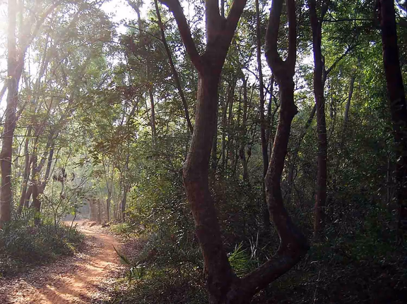
Morning in an Auroville forest
What follows attempts to demonstrate how the water situation we are in actually came about, and suggests a strategy that addresses the problem at its root cause. Most of what we are told by specialists is reactionary in nature, and I am sure that we can all agree that Auroville ought never to be reactive, but always at the forefront of the new and seemingly impossible. Water cannot be dissociated from the health of the land, the soils and the climate. Tackling the water issue requires more than water reservoirs; it requires changing the climate altogether. And there are not a million ways to do that.
Forest: a terrestrial imperative
Forests are the life-support systems for complex biological life and genetic diversity on Earth. They are the regulators of the climate, the natural design perfected over hundreds of millions of years which relentlessly maximizes the potential of biological life. Old-growth forests are ecosystems which sustain the highest degrees of intelligence, diversity and balance. They are the apex of terrestrial biological evolution; the levels of ecological intricacy and interdependence, and the density of life they harbour, are bewildering.
Moreover, anywhere on Earth where a single woody plant is growing, there either once was a forest, or there will be (once more) a forest. In the tropical belt, the protection of even a tiny piece of land from all forms of human disturbance, especially fire and grazing, will rapidly result in the increase of plant diversity. If the protection of the land can be sustained for a long period of time, then the vegetation will eventually evolve into an evergreen jungle thousands of species rich.
In other words, the primary reflex of the Earth is the shielding of the ground by vegetation. For only once the ground is thus protected with a carpet of photosynthesizing and carbon-fixing biomass can an environment wealthy and stable enough to sustain complex life-forms be created. In the tropical belt where available solar energy is the highest on Earth, closed-canopy evergreen jungle is the inherent identity of the land.
Forests are models of efficiency
Indeed, no other landscape on Earth as effectively capitalizes on the two basic life-inputs on Earth: solar energy and precipitation. When a forest has reached a state of maturity, it becomes a model of energetic and hydric efficiency: close to zero energy from the sun is wasted and lost through heat, and none of the rain is wasted, neither through run-off nor evaporation. In terms of efficiency therefore, every non-photosynthesizing surface of barren ground is, no pun intended, rock-bottom.
Consequentially, maintaining a minimum ratio of forest cover to non-forest cover is indispensable to prevent a cascade of ecological and hydric degradation to ensue.
The photosynthesizing capacity of the land evolves in parallel with its water-storage capacity. An energetically efficient piece of land is hydrologically efficient too. The land therefore incrementally expands its hydric capital through the growth of biomass, becoming ever-more resilient to climatic extremes. The forest system biodiversity grows until reaching a theoretical state of climax, wherein the biomass per unit of surface of land has reached a maximum. The climax forest is therefore land on which the highest possible amount of water is contained in a regularized and stable manner.
Water and the climate, two sides of the same coin
The water situation cannot be isolated from the general environmental and climatic contexts on Earth. They are the expressions of the same problem: too many heat radiating and evaporating surfaces on Earth, and hugely insufficient photosynthesizing and percolating ones. The massive over-consumption of water is not the cause of our troubles, but rather it is a terminal stage of a long, drawn-out parasitical disease. Insufficient recharge is a far more significant, and old, cause.
By changing the climate, one can expand the hydric capital of the land. Water scarcity is the outcome of thousands of years of global deforestation and the systematic replacement of closed-canopy jungle with grasslands, fields and other highly impervious surfaces. In India, this biological and hydric depletion is millenniums old. The drying-up process began with the first extensive felling of the trees and continued with the relentless burning down of forests for agriculture and grazing, resulting in a steady erosion of the hydric capital that had been created over millions of years. The entire climate was changed once the peninsula was denuded beyond a certain point. The vicious cycle of degeneration began once losses of biomass (therefore water) were significant enough to eat away at the biological (therefore hydric) capital of the land, creating a state of structural deficiency.
The depletion of biomass outpaced its production. Microclimates were annihilated. The land became ever-more vulnerable to a deregulated climate, deprived henceforth of its quintessential natural regulator.
Vegetation corresponds to the above-ground hydric capital which is inseparable from the sub-terrain water aquifers. It is a single dynamic body, the forest representing the dynamic outer membrane constantly maximizing every available input, regularizing the hydrologic cycle so as to minimize losses of moisture from the overall system. It is just that the depletion of this hydric capital began from the top-down, and today, we find ourselves drilling hundreds of meters into the ground in search of the last drops of sweet water.
Unless we recreate sufficient surfaces of land covered with protected forest, we will not be able to replenish the aquifers nor be able to change the climate. The health of our aquifers is directly connected with the health of our watersheds. And the health of our watersheds is directly correlated with the health and extent of the forests on them. And our climate is the result of the extent and quality of our forests.
The Auroville context
It is self-evident that Auroville should represent a model for our local brothers, for India and the world, to follow. Attempting to solve the water crisis today without looking at drastically increasing the recharge of the first and second aquifers is perpetuating the status-quo. The problem must be solved at its origin, and the origin of the water crisis is degraded watersheds with hugely insufficient forest cover.
Until every piece of Auroville land is capable of holding and storing the biggest rains of the century, it is awfully wrong to look at capital-intensive works of engineering seeking to do quite the opposite of what needs to be done: our specialists are suggesting that many moneys be spent in increasing run-off and collecting it in ponds and reservoirs to be subsequently utilized for our consumption. The argument of course is that all the good work that we (who is actually doing this work?) do in recharging the water aquifers is annulled by the short-sighted habits of our local agriculturist brethren. Therefore, we are told, let us collect the water and save it for us instead.
Well, such a strategy does not address the problem at its source; it is reactionary and therefore I tend to think it has no place in Auroville.
Moreover, the only lands of Auroville which are actually recharging any rainwater are those managed by the Forest Group. All the rest are unable to hold even average, gentle rains. And yet, our forests are threatened relentlessly from within by our own self-proclaimed mayors and planners, and from without by the boundless greed of speculators and land owners.
Unfortunately, the question of water in Auroville cannot be decorticated without addressing urban planning. There is no politics here; this is about looking at facts and realities without any lenses or blinkers. The hydrogeological reality of the Auroville plateau does not match with the design and land-usages of the Master Plan.
If everyone would now focus on increasing surface runoff in order to set it aside for their own use, the water situation would be worsened to a point of sheer catastrophe. If the general strategy in India and the rest of the world facing water shortages is one of harvesting rainwater and centralizing the dwindling resource in increasingly artificial systems, then one can rather confidently predict civil war, the salinization and drying-up of aquifers, structural drought and flooding. For such a strategy implies doing the exact opposite of what not just Auroville urgently needs to do, but the entire human population too: change the climate on Earth.
Suggestions: maximize percolation, minimize evaporation
The first thing to do is to set a target of reaching 100% infiltration on all Auroville lands and to immediately stop erosion and massively reduce runoff. Our only water-input comes from rains, and the majority of the rainwater comes down in high intensities. The present state of our watersheds is such that we are not able to capitalize on above-average rains, which are simply wasted through runoff and massive evaporation.
This implies establishing land-use plans at the scale of the plateau’s watersheds. The management objective should be: maximization of percolation and minimization of evaporation. This principle of management should apply for all types of land-use, from dense human habitat, to agriculture and to forest. At the scale of the watershed, the overall objective should be the capture and storage of the biggest century rain (1m in 24h) without generating any erosion. For most Auroville lands, that represents about a ten-fold leap in hydrologic effectiveness.
To do that, unfortunately, one must look literally and figuratively beyond the circles, and make adjustments where required and based on topography and hydro-geology.
Ideally, all the ravines should be identified as sensitive hydrologic zones and be protected on either side by a band of evergreen forest at least as wide as the width of the ravine, twice when
possible. These ravines and their buffers should be densely planted with evergreen trees and then left entirely undisturbed.
To the extent possible, the ridges of the plateau should be covered by bands of protected evergreen forest.
The sensitive recharge areas of the plateau, such as the pebble outcrops which feed the first aquifer, should be set aside and managed as protected evergreen forest.
The existing patches of forest under the Forest Group’s administration should be recognized as vital recharge zones, energy-efficient and carbon-fixing land-units. They need to be protected for posterity and the efforts of their stewards in establishing a closed-evergreen canopy should be supported by our institutions of governance.
Forest corridors between fragmented forest patches should be created, and a general movement of forest extension northward on the Rayapudupakkam, Aprampet and Mathur watersheds should be set in motion. That area represents the last chance of creating a contiguous forest large enough to establish a micro-climate in the Auroville region and effectively increase recharge of the aquifer in the long-term. Similarly, an extension of forest cover on the pebble-outcrops to the south of the plateau, linking the Ashram lands on the shores of Ousteri, would do wonders. Collaboration with the Ashram in managing that sensitive hydro-geologic area would be great, given the amount of land under their ownership.
In our denser habitat zones, ornamental plants requiring abundant watering, as well as lawns, should be replaced by local drought-resistant shrubs and trees. If planted appropriately around each building complex, all the rainwater unable to percolate because of the impervious surfaces would be able to infiltrate through densely planted percolation groves. Evergreen shade should be created over the largest surfaces possible. By doing that, micro-climates could be created; temperatures would be strongly reduced and moisture-content in the soil generally increased.
Finally, one could suggest the following to Varuna: for a renewable period of three years, Aurovilians will pay the totality of their electricity bills and the equivalent of the 2018 electricity subsidy should instead be spent on land purchase for reforestation and water conservation every year.
Conclusion
Once our watersheds are able to incrementally expand their hydric-capital, then locally and in certain cases, one could practice certain forms of water harvesting. For water harvesting as we have seen is quite the opposite of water conservation. In the latter, the objective is the regularization of the climate and the creation of a resilient environment with healthy hydric reserves. In the former, it is the extraction of a dwindling resource for human ends.
This is, however, not just an Auroville task. The re-greening of the planet and especially the tropical belt is an indispensable step that our species will have to take. Of all places on Earth, Auroville should not repeat history and replicate old systems of thought. It should pave the way for the future, and the future will be one of massive watershed restoration and reforestation throughout the globe, because without that, there simply won’t be any future. It is an existentialist imperative.
Forests are in fact water. That is a determinism on this planet of ours. The sooner we accept that, the better off the next decades will be for this spiritual undertaking that is Auroville, and therefore for the whole world.
If we began today, we could change the climate on Earth radically in a couple of decades. And that work needs to be started right here in good-old Auroville.
Rishi Walker was born in Auroville, studied in the French Lycée in Pondicherry and went to college in Aix en Provence, France, from where he graduated in 2008. He became steward of Kamataru Forest in the Auroville Greenbelt in 2014.

* Petrichor is the smell the first drops of rain  make on dry ground.